![]() | ![]() | ![]() | ![]() | ![]() |
|
![]() | ![]() | ![]() Illinois Landscapes
Landscape of Northern Vermilion County
| ![]() |
||
![]() | ![]() | ![]() | ![]() |
||
![]() | ![]() | ![]() | ![]() | ![]() | ![]() |
![]() |
|||||
![]() |
GeoT Geography | Glacial Erratic Boulders | The Ultimate Erratic? | Ultimate Erratic -- Page 2 | Glacial Landforms -- 1 | Glacial Landforms -- 2 | Glacial Landforms -- 3 | Glacial Landforms -- 4 | Loess and Sand Dunes | Hoopeston's Location | Landscape of Northern Vermilion County | Penfield Illinois
| ![]() |
|||
![]() |
![]() |
||||||||||
![]() | ![]() |
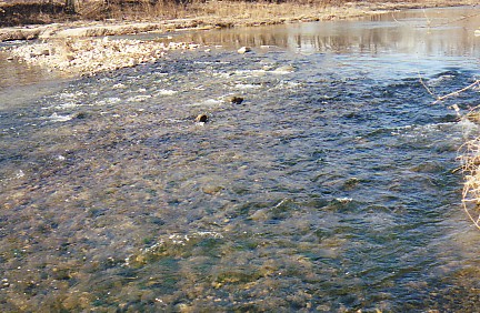
![]() Rapids along the Middle Fork of the Vermilion River, near Danville, Illinois. | ![]() | ![]() |
||||||
![]() |
||||||||||
![]() | ![]() | ![]() | ![]() | ![]() | ![]() | ![]() | ![]() | ![]() | ![]() | ![]() |
![]() | ![]() | ![]() | ![]() | ![]() | ![]() | ![]() | ![]() | ![]() | ![]() | ![]() |
![]() | ![]() | ![]() | ![]() | ![]() | ![]() | ![]() | ![]() | ![]() |
||
![]() | ![]() | ![]() | ![]() | ![]() | ![]() | ![]() | ![]() | ![]() | ![]() | ![]() |
![]() | ![]() | ![]() | ![]() | ![]() | ![]() | ![]() | ![]() | ![]() | ![]() | ![]() |
![]() |
||||||||||
![]() | ![]() | ![]() | ![]() |
|||||||
![]() |
||||||||||
![]() |
||||||||||