GeoT Geography
Topographic Map of Hoopeston


Home | Chat | Online Geography Textbook | Geography Answers | Geography Games | News Sources | Geology | Landscape of Northern Vermilion County | Topographic Map of Hoopeston | Illinois Landscapes | Impact Breccias | Articles | Hoopeston from the Air


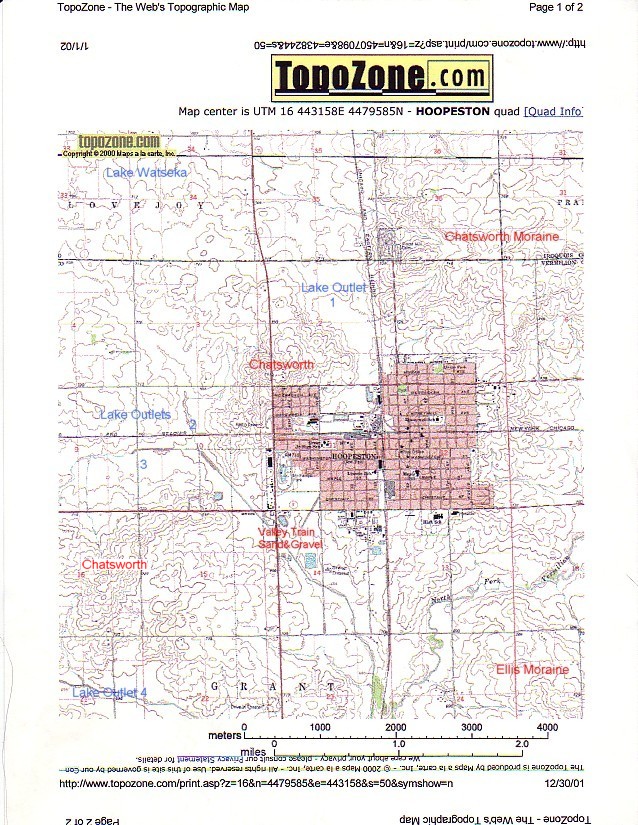
Lake Outlets Through the Hoopeston Area

1 inch ='s approximately 1/2 mile

loess2.jpg

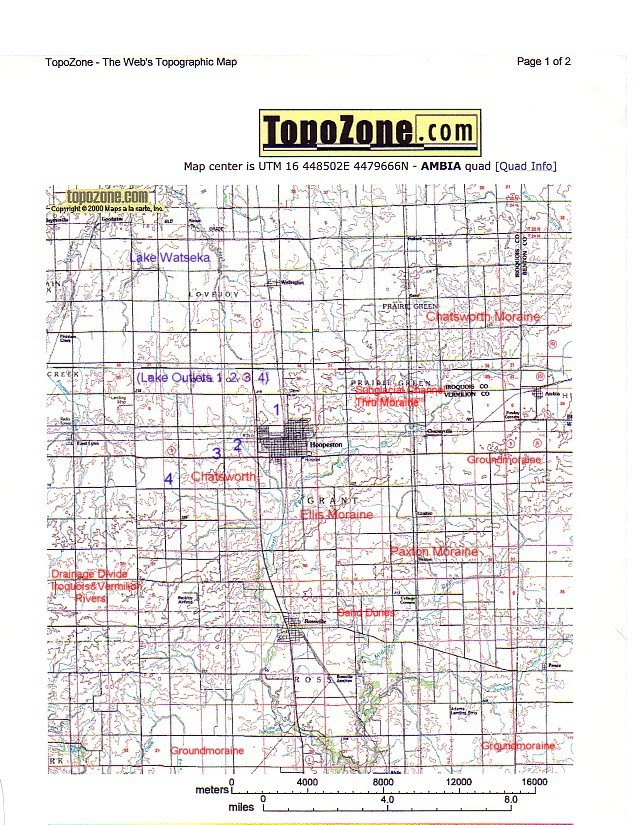
Wider View of the Hoopeston Glacial Landscape

1 inch ='s approximately 2 miles

loess2.jpg

The moraines were formed by pauses and readvances of glacial ice.

Note how the moraines are separate from one another southeast of Hoopeston, but merge into each other to the southwest.

The Chatsworth moraine acts as a stream divide separating drainage ultimately going to either the Illinois River (north) or Wabash River (south).