|
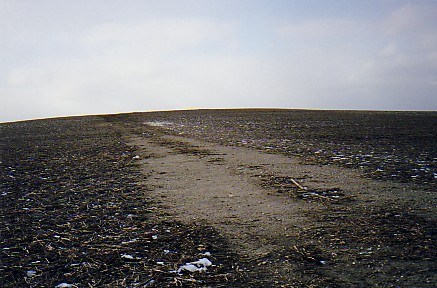
A small, low kame?
Photo just south of Rankin, Illinois.
The evenly rounded form suggests this
is not
a moraine crest -- though this
feature lies within a moranic complex.
Kames form when meltwaters run off the
top of a glacier, or through an opening
within the ice. Either way, till is sorted
by the flowing water and
builds into rounded
masses of sand and gravel.
Should this turn out NOT to be a kame -- it
certainly could
pass for one!
The path leading to the top is composed of sand
and gravel -- perhaps a former driveway.
Frozen
ground this day precluded further investigation.
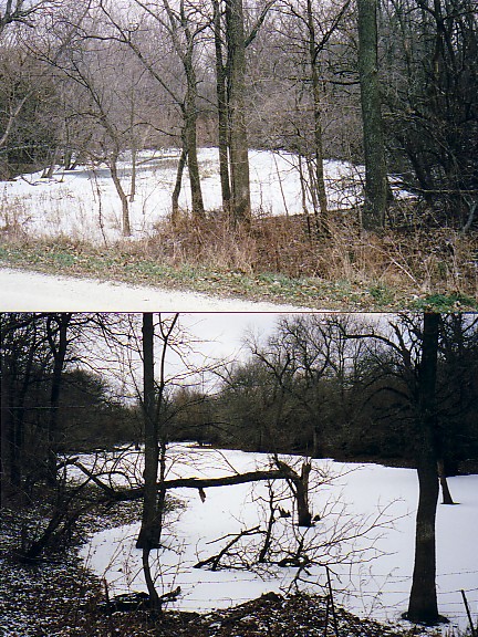
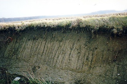
Meander scar and oxbow along the Middlefork River, southern Ford county. The road grade separates what was once a continuous
feature.
The scar is preserved in an outwash terrace and marks a previous level and location of the Middlefork.
The present day Middlefork lies nearby, but entrenched at a lower elevation.
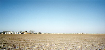
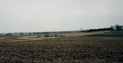
This photo taken near Flatville, Illinois, suggests the reason for the name of the town!
Generally this surface is
groundmoraine, and a reason why Champaign county, and the city of Champaign received their names . . . from the french word
for flat!
This very poorly drained area required construction of deep drainage ditches and field tile to make it
arable, it is an extremely productive agricultural area today.
Click Here: Field trip to Glacial Park
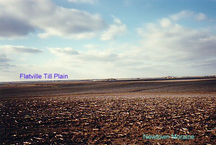
The view is from a crest of the Newtown moraine near Gifford, Illinois, looking southwest to the much lower Flatville till
plain.
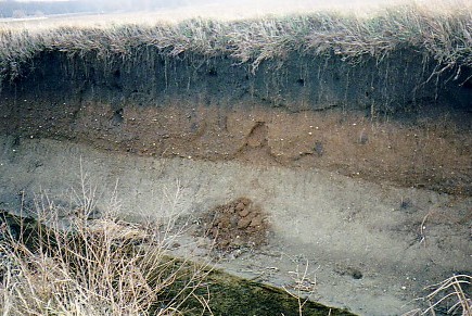
Modern soil grades into poorly sorted outwash overlying glacial till.
Ditch east of Ellis, Illinois.
Note
the minor slide of outwash.
Note the small erratic in the process of being released from the glacial till.
This small pond may be in a depression called a kettle.
Kettles form when a block of ice is detached from the glacier
and is partially covered by drift.
When the ice block melts, a depression is left in the surface.
|